Topographic Surveys: Mapping the Foundation for Design
Precision Data for Architects, Engineers, and Developers
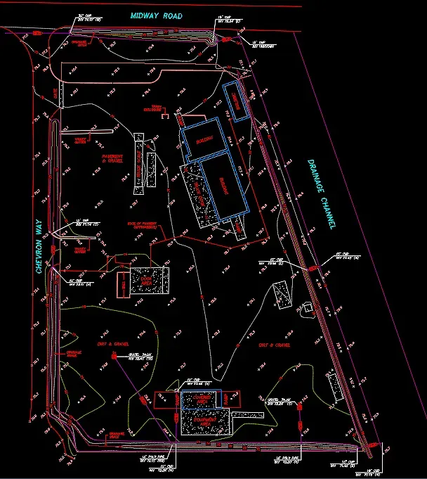
A Topographic Survey (or "Topo") is more than just a map; it is a three-dimensional representation of your land. At Cardinal Land Surveying, we provide the detailed "base map" that architects and engineers rely on to design everything from custom homes and grading plans to large-scale commercial developments.
By mapping the "lay of the land," we ensure your design team can account for every elevation change, utility line, and existing structure before construction begins.
What Is Included in a Topo Survey?
While a boundary survey focuses on property lines, a topographic survey focuses on features and elevations. Our comprehensive mapping includes:
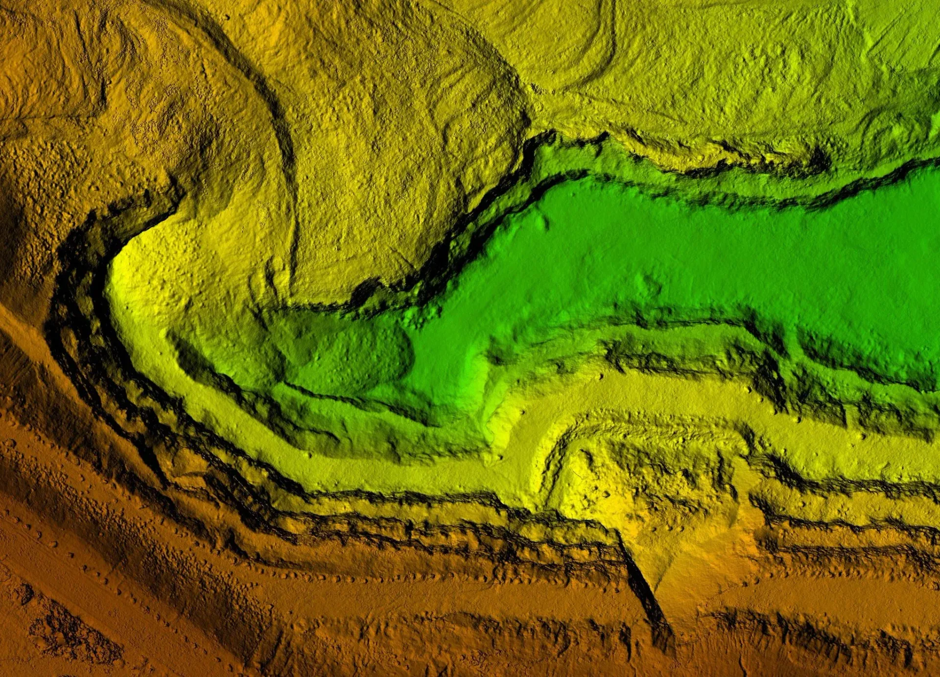
Contour Lines & Elevations
Showing the rise and fall of the terrain to calculate drainage and grading.
Existing Improvements
Precise locations of buildings, fences, retaining walls, and paved areas.
Utility Mapping
Locating visible evidence of underground utilities, including manholes, valves, and utility poles.
Natural Features
Mapping significant trees (with drip lines and diameters), water features, and rock outcroppings.
Digital Terrain Models (DTM)
Creating a 3D digital skeleton of the land for advanced engineering analysis.
Why a Topographic Survey is Critical
Starting a project without an accurate Topo is a significant risk. Our surveys are essential for:
Site Design & Planning
Providing the "empty canvas" for architects to place buildings and infrastructure.
Drainage & Hydrology Studies
Identifying where water collects and flows to prevent future flooding issues.
Earthwork Calculations
Helping contractors determine how much dirt needs to be moved, saved, or brought to the site.
Permitting Requirements
Most municipalities in Solano and Contra Costa Counties require a stamped topographic survey for any significant grading or building permit application.
High-Tech Deliverables for Modern Workflows
We understand that our data needs to be ready for your design team. We provide high-quality deliverables in multiple formats, including:
AutoCAD (DWG) Files
Fully layered and labeled for immediate use in design software.
Civil 3D Surfaces
Including Digital Terrain Models (DTM) for engineering professionals.
High-Resolution PDF Maps
Clear, stamped, and ready for submission to planning departments.
Frequently Asked Questions
Do I need a boundary survey if I am getting a topo?
Usually, yes. An "integrated" survey that combines both boundary and topography is the best way to ensure your new building or addition respects all legal property setbacks.
How do you determine the "zero" elevation?
We typically tie our surveys to local benchmarks or use high-precision GPS to establish elevations based on the North American Vertical Datum (NAVD88).