Digital Terrain Modeling (DTM): High-Accuracy Bare Earth Data
The Gold Standard for Engineering & Hydrological Analysis
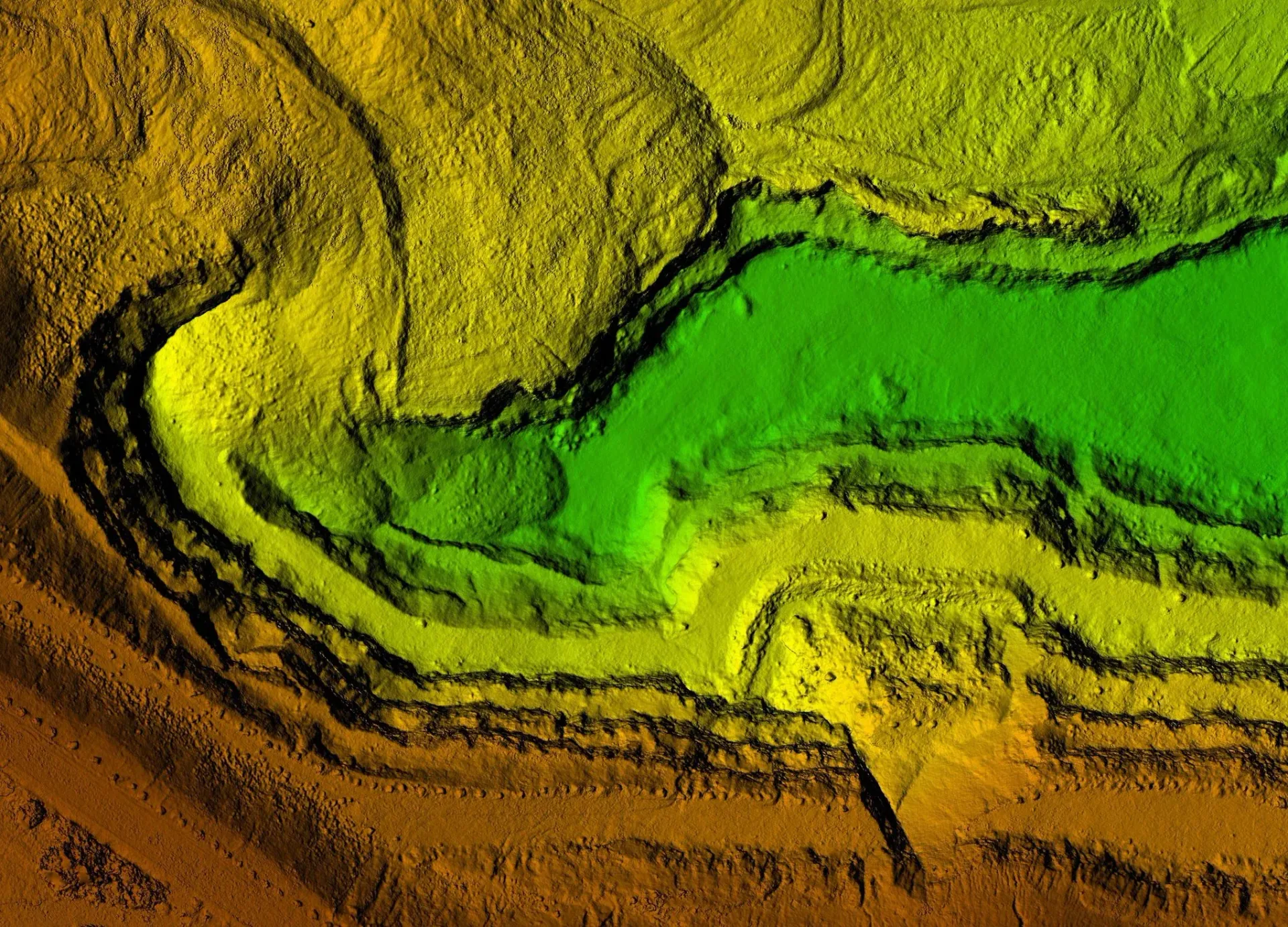
A Digital Terrain Model (DTM) is a high-precision, 3D digital representation of the "bare earth" surface. Unlike standard elevation models, a DTM from Cardinal Land Surveying removes all non-ground features—such as buildings, dense vegetation, and vehicles—to reveal the true shape of the underlying terrain.
For civil engineers, hydrologists, and developers in the North Bay and East Bay, a DTM is the essential foundation for drainage studies, flood modeling, and grading design.
Why Your Project Needs a DTM
A DTM provides a level of analytical detail that a 2D map cannot. Our models are used throughout Solano and Contra Costa Counties for:
Drainage & Flood Analysis
Precisely determine where water enters, flows across, and exits a site—crucial for FEMA compliance and storm drain design.
Earthwork & Volumetrics
Calculate exact "cut and fill" quantities to minimize soil export/import costs.
Slope Stability Studies
Identify high-risk areas on steep terrain before structural design begins.
Infrastructure Alignment
Optimize the path of roads, pipelines, and utilities based on the natural contours of the land.
Precision Data Capture: Ground to Air
We utilize multiple technologies to ensure your DTM is built on a foundation of "ground truth":
Traditional Field Stacking
Our ground crews collect precise breaklines (curb faces, toes of slopes, and ridges) to ensure the model reflects sharp changes in elevation.
Aerial LiDAR
For heavily wooded or large-scale sites, our drone-mounted LiDAR "sees through" the canopy to map the ground surface where traditional cameras cannot.
Total Station Integration
We tie every model to local benchmarks and the NAVD88 vertical datum for survey-grade vertical accuracy.
Engineer-Ready Deliverables
We deliver DTMs that are ready to drop into your design environment. Our typical deliverables include:
Civil 3D Surfaces
Fully attributed TIN (Triangulated Irregular Network) surfaces.
Breakline CAD Files
3D polylines defining the critical skeleton of the terrain.
Point Cloud Data
High-density XYZ data points for advanced 3D modeling.
LandXML
A universal format for seamless transfer between different engineering software.
Frequently Asked Questions
What is the difference between a DTM and a DSM?
A Digital Surface Model (DSM) captures the tops of trees and buildings. A Digital Terrain Model (DTM) filters those out to show only the ground surface. For engineering design, a DTM is almost always the required product.
Can you provide a DTM for a site with thick brush?
Yes. Using our Aerial LiDAR technology, we can penetrate most vegetation to get a reliable bare-earth model without the need for manual clearing.