Professional Land Surveyor in Rancho Cordova, CA
If you're looking for a reliable land surveyor in Rancho Cordova, Cardinal Land Surveying provides professional surveying services for homeowners, developers, contractors, engineers, commercial property owners, and public agencies throughout the area.


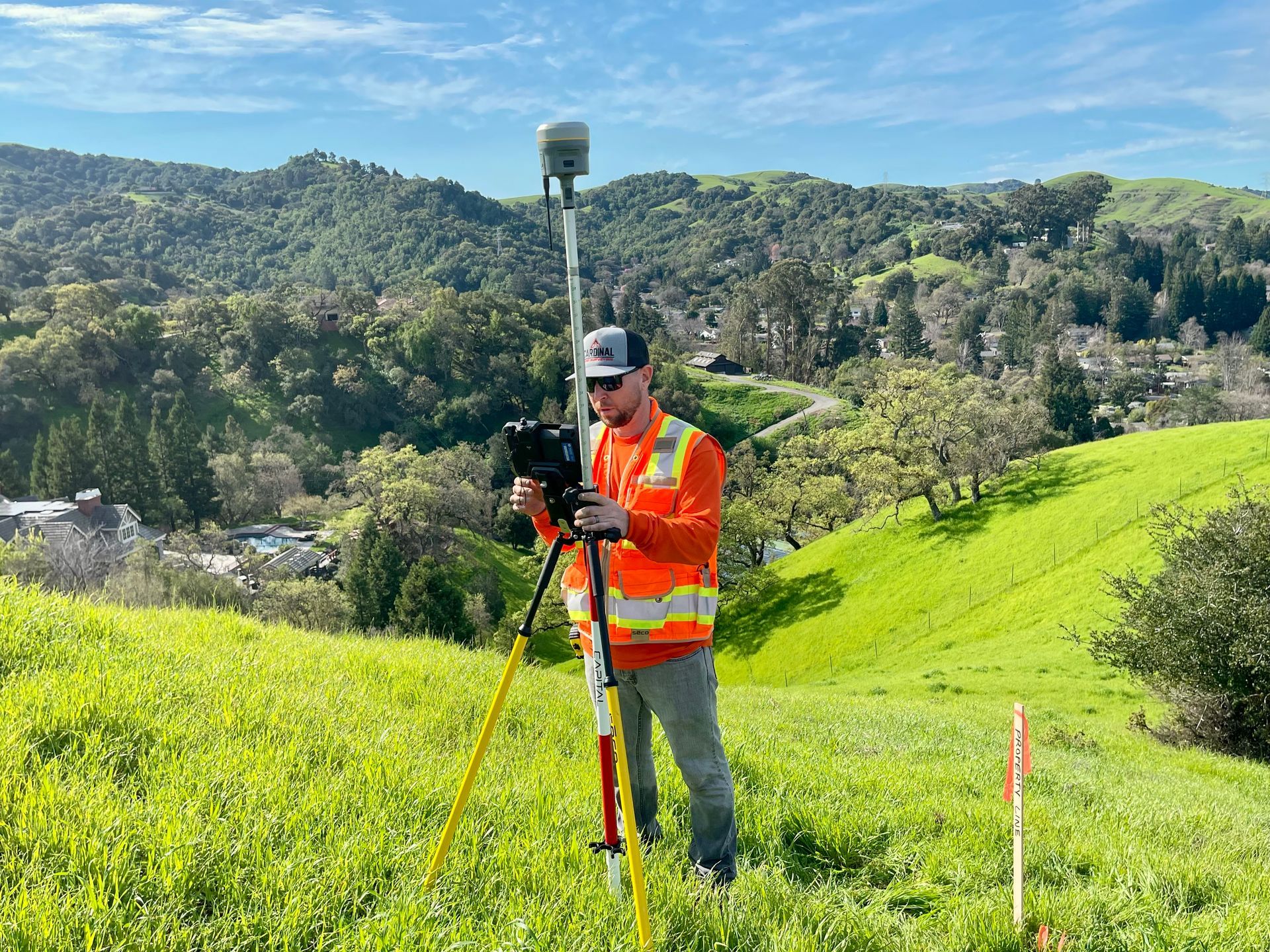
From residential property improvements to large-scale commercial and industrial developments, accurate surveying is the foundation of every successful project. Our team delivers precise field data, thorough research, and dependable survey solutions that help clients move forward with confidence.
Rancho Cordova continues to be one of the Sacramento region’s most active areas for residential growth, industrial development, infrastructure improvements, and commercial investment. As development expands throughout the city, professional land surveying services are essential for planning, design, permitting, construction, and property transactions.
Whether you're planning a new development, purchasing property, constructing improvements, or resolving boundary concerns, Cardinal Land Surveying is ready to assist with your surveying needs.
Land Surveying Services We Provide in Rancho Cordova
Boundary Surveys
Boundary surveys establish the legal limits of a property and identify property corners, easements, encroachments, and potential boundary conflicts. These surveys are commonly needed before building fences, additions, retaining walls, or other site improvements.
Topographic Surveys
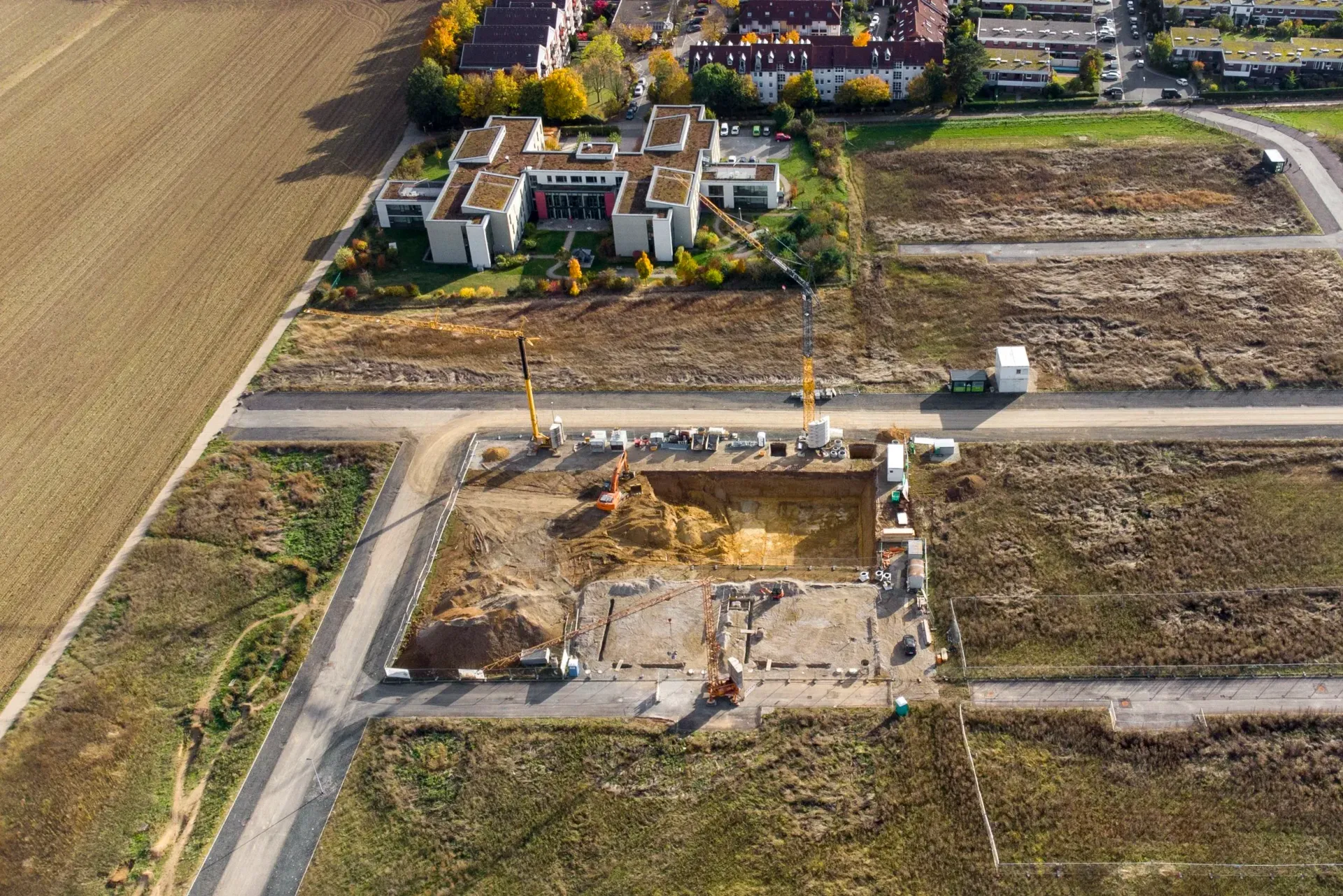
Topographic surveys document existing site conditions including elevations, drainage patterns, utilities, structures, pavement, trees, and other physical features. These surveys provide the foundation for engineering design and development planning.
Construction Staking
Construction staking helps ensure buildings, utilities, roadways, and site improvements are built according to approved plans. We provide accurate layout services for residential, commercial, and public works projects.
ALTA/NSPS Land Title Surveys
Commercial property transactions often require ALTA surveys to satisfy lender, title company, and development requirements. Our team provides detailed surveys that support acquisitions, financing, and project planning.
Parcel Maps & Lot Splits
Property owners and developers throughout Rancho Cordova often seek opportunities to subdivide land or create additional parcels. We assist with parcel maps, lot line adjustments, and subdivision mapping services.
Record of Survey Preparation
When required by California law, we prepare and file Records of Survey documenting boundary determinations and survey findings.
Easement & Right-of-Way Surveys
We provide surveys that identify existing easements, utility corridors, access rights, and right-of-way boundaries for private and public projects.
Supporting Rancho Cordova's Growth
Rancho Cordova has become one of the Sacramento area's fastest-growing business and development hubs. The city features a mix of established residential neighborhoods, expanding commercial districts, industrial business parks, and ongoing infrastructure improvements.
Surveying services are frequently needed for:
Residential additions and property improvements
New housing developments
Commercial construction projects
Industrial facilities and warehouses
Utility and infrastructure projects
Property acquisitions and sales
Site development and entitlement projects
Transportation improvements
Our experience working throughout the Sacramento region allows us to efficiently support projects at every stage of development.
Why Choose Cardinal Land Surveying for Rancho Cordova?
Local Knowledge
We understand the unique land development processes, permitting requirements, and surveying challenges found throughout Rancho Cordova and Sacramento County.
Accurate Data Collection
Using modern surveying equipment and technology, we provide precise measurements and dependable survey deliverables.
Responsive Service
We understand that survey information often impacts project schedules and deadlines. Our team works efficiently to help keep projects moving forward.
Comprehensive Project Support
From a simple residential boundary survey to a large commercial development, we provide the expertise necessary to support successful projects.
Rancho Cordova Property Owners Trust Professional Surveying
Many properties throughout Rancho Cordova were developed over several decades, creating situations where original monuments may be difficult to locate or where property records require extensive research.
Having accurate survey information early in a project often helps avoid costly delays and unexpected issues later.
Professional surveying can help:
Confirm property boundaries
Prevent construction disputes
Support permit applications
Verify easements and access rights
Assist with property purchases
Provide accurate design information
Support land development projects
Common Surveying Challenges in Rancho Cordova
Urban Development & Redevelopment
Sacramento's continued growth creates increasing demand for accurate property boundary verification, topographic mapping, and construction layout services.

Floodplain Considerations
Areas near the Sacramento River, American River, and surrounding waterways often require specialized elevation and flood-related surveying services.

Aging Property Records
Many established Sacramento neighborhoods contain historic parcels where boundary research and field verification are critical for accurate property line determination.
Infrastructure Expansion
Roadway improvements, utility upgrades, and public works projects throughout the region require detailed surveying and mapping support.
Frequently Asked Questions
How much does a land survey cost in Rancho Cordova?
Survey costs vary based on property size, terrain, record research requirements, and the type of survey being performed. We provide customized proposals based on each property's specific needs.
When should I get a boundary survey?
A boundary survey is recommended before building fences, additions, retaining walls, accessory structures, or when purchasing property. It helps confirm property lines and identify potential encroachments.
What is included in a topographic survey?
A topographic survey typically includes elevations, contours, structures, utilities, drainage features, pavement, trees, and other existing site conditions needed for design and engineering purposes.
Do commercial developments require surveys?
Yes. Most commercial projects require various types of surveying services including boundary surveys, topographic surveys, construction staking, and ALTA surveys.
Can you help with lot splits and subdivisions?
Absolutely. Cardinal Land Surveying assists property owners and developers with parcel maps, lot line adjustments, subdivision mapping, and land development support throughout Rancho Cordova.
What is an ALTA Survey?
An ALTA/NSPS Land Title Survey is a detailed survey used primarily for commercial real estate transactions. It helps identify property boundaries, easements, improvements, and other important site information.
How long does a survey take?
Project timelines vary depending on survey type, property size, and complexity. Smaller residential surveys may be completed relatively quickly, while larger commercial and development projects often require additional time.
Do you provide surveying services outside Rancho Cordova?
Yes. We serve clients throughout Sacramento County and surrounding communities including Sacramento, West Sacramento, Folsom, Elk Grove, Davis, Woodland, Roseville, Rocklin, and beyond.
Request a Survey Proposal in Rancho Cordova
Whether you're planning a residential improvement, commercial development, property purchase, or infrastructure project, Cardinal Land Surveying provides professional land surveying services throughout Rancho Cordova and the greater Sacramento region.
Contact our team today to discuss your project and request a survey proposal.